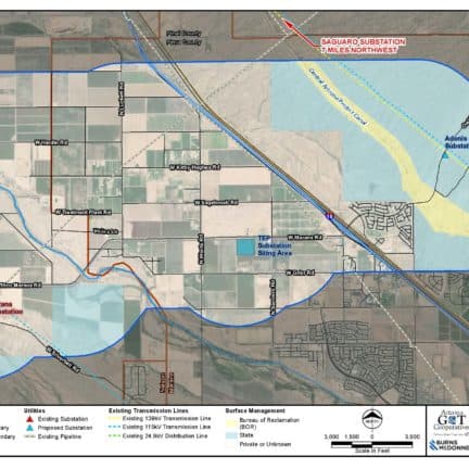
To determine the criteria locations, we first identified the landowners, jurisdictions, and agencies within the Project study area to determine existing and planned land use and jurisdictional planning guidelines. Cities, towns, and counties in the study area typically have long-term plans that consider potential expansion of their current jurisdictional boundaries. These broader jurisdictional planning areas are reflected in officially adopted General Plans or Comprehensive Plans and identify desired future land use plans, including residential, commercial, industrial, recreations, educational, etc. uses to be considered for development within the community. These jurisdictional planning areas are important to consider when planning new electrical infrastructure, such as the proposed 115kV transmission lines. The following map shows the land ownership and jurisdictional boundaries within the study area.

